


Kerala Accommodation
Kerala Amusement Parks
Kerala Archeology
Kerala Art Forms
Kerala Ayurveda
Kerala Backwaters
Kerala Banks
Kerala Beaches
Kerala Bird Sanctuaries
Kerala Builders
Kerala Cinema
Kerala Churches
Kerala Cities
Kerala Cuisine
Kerala Dams
Kerala Destinations
Kerala Dress Code
Kerala Education
Kerala Forts
Kerala Hill Stations
Kerala Hospitals
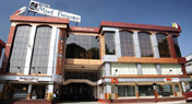
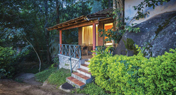
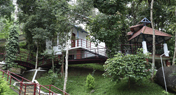
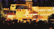
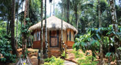
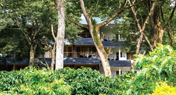
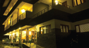
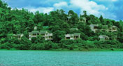
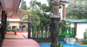
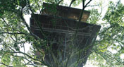
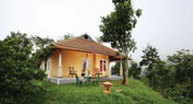
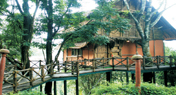
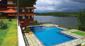
Kerala Hotels and Resorts
Kerala Map
Kerala Mosques
Kerala Museums
Kerala National Parks
Kerala News
Kerala Palaces
Kerala Pilgrimage
Kerala Reservoirs
Kerala Restaurants
Kerala Shopping
Kerala Spices
Kerala STD Code Finder
Kerala Temples
Kerala Tourism
Kerala Tour Operators
Kerala Waterfalls
Kerala Wildlife Sanctuaries
Kerala Zoos
Monsoon Tourism
Time Convertor
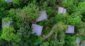
Kerala | KeralaTourism | Wayanad Attractions
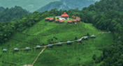
With its picturesque mist-clad hill stations, sprawling spice plantations, luxuriant forests and rich cultural traditions Wayanad becomes the most unexplored tourism destination in the God’s Own Country. Wayanad is set lofty on the majestic Western Ghats with altitudes ranging from 700 to 2100 Meters above mean sea level. The all green district is also the abode of adventure tourism. It is an orchard of spices like pepper and turmeric, rubber, coffee and tea plantations. Wayanadan Manjal Muricha Pole… is a line from Vadakkan Pattu, one of the very popular folk songs, extolling the heroes of gone by years, which means as bright as the cut portion of Wayanadan Manjal. Wayanadan turmeric has more dying colour and alchemic power. This district is the birth place of many heroes of martial arts. The Kurichiyar who formed the army of Pazhassi Veera Kerala Varma Raja were the experts of martial arts. The district also is the home of a small Jain Community. Wayanad also produces a sizeable quantity of rice and its name derived from two Malayalam word Vayal Nadu which means land of paddy fields.
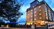
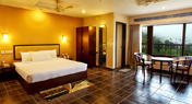
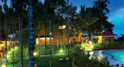
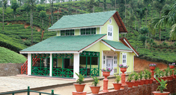
Wayanad Tourism Destinations | Wayanad Hotels and Resorts

- Fact Sheet
- STD Codes
- Access
- Communication
Area: 2,131 sq km
Population (2011): 8, 16,558
Male: 4, 01,314
Female: 4, 15,244
Altitude: 700-2100 meters above sea level
Tourist Season: August-March
Kalpetta ++91 4936
Lakkidi ++91 4936
Mananthavady + +91 4935
Meppady ++91 4936
Sulthan Bathery ++91 4936
Vythiri ++91 4936
Air: Nearest Airport is Calicut International Airport, Ph: 0483 2719491.
Rail: Nearest Railway Station is Kozhikode, Ph: 0495 2702606.
Road: KSRTC Bus Station Mananthavady, Ph: 04935 240640. KSRTC Bus Station Kalpetta, Ph: 04936 202611. KSRTC Bus Station Sulthan Bathery, Ph: 04936 220217.
DTPC, Kalpetta, Ph: 04936 202134
DTPC, Pookot, Ph: 04936 255207
Tourist Information Office, Ph: 04936 204441
Wayanad Heritage Museum, Ph: 04936 260127
Wayanad Destinations
Banasura Sagar Dam:(24 km from Kalpetta and 34 km from Mananthavady) Considered to be the largest earth dam in India, the Banasura project precincts are an ideal starting point for treks to the Banasura Peak. An interesting feature is a set of islands that were formed when the reservoir submerged the surrounding areas.
Chain Tree: (16 km from Kalpetta, 41 km from Sultan Bathery and 51 km from Mananthavady) This large Ficus tree, bound by a prominent chain is the source of a dramatic local legend. As the tale goes, an Adivasi youth named Karinthandan was instrumental in guiding a British Engineer through the difficult mountain terrain into Wayanad. Eager to take credit for the discovery, the engineer conveniently killed his guide, whose soul according to the legend constantly haunted subsequent travelers. It is further believed that a priest chained the troublesome spirit onto this tree.
Edakkal caves: (28 km from Kalpetta, 12 km from Sultan Bathery and 45 km from Mananthavady) An interesting trek up the Ambukuthi Hill near Ambalavayal town takes you to the fascinating neolithic cave site of Edakkal. Etchings found on the walls of these caves have drawn the serious attention of archaeologists and historians worldwide.
Chethalayam Falls: (37 km from Kalpetta, 12 km from Sultan Bathery and 54 km from Mananthavady) Chethalayam is one of Wayanad’s smaller waterfalls. Its surroundings offer a number of vantage points for bird-watching.
Kanthanpara Falls: (22 km from Kalpetta, 23 km from Sultan Bathery and 57 km from Mananthavady) Relatively smaller than Sentinal Rock, and rather less frequented, Kanthanpara and its surroundings are nonetheless very pleasant.
Karalad Lake: (16 km from Kalpetta, 41 km from Sultan Bathery and 25 km from Mananthavady) A 7 acre lake with a charming grove surrounding it, Karalad is now being developed as a recreational park with facilities for boating and angling.
Karapuzha Dam: (16 km from Kalpetta, 16 km from Sultan Bathery and 46 km from Mananthavadi) This large irrigation based dam site is set amidst picturesque surroundings. It is a great place for picnics.
Chembra Peak: (17 km from Kalpetta and 42 km from Sultan Bathery) At 2100 metres, the spectacular Chembra Peak located towards the southern part of Wayanad is the tallest summit in the region.
Korome Mosque: (47 km from Kalpetta, 52 km from Sultan Bathery and 23 km from Mananthavady) This nearly 300 year old mosque is built in traditional Kerala style with extensive wood carvings. Originally built by local Nair gentry, Korome Mosque to this day is seen as a sterling example of communal amity.
Phantom Rock: (26 km from Kalpetta, 12 km from Sultan Bathery and 43 km from Mananthavady) Located close to Ambalavayal town, Phantom Rock; named so because of its skull head shape, is locally called Cheengeri Mala.
Meenmutty Falls: (29 km from Kalpetta and 28 km from Sultan Bathery) A interesting 2 km jungle trek off the main Ooty Road, Meenmutty is the largest and most spectacular waterfall in Wayanad.
Muniyara: (27 km from Kalpetta, 11 km from Sultan Bathery and 44 km from Mananthavady) Excavations at various points around the foot of the Ambukuthi Hill have unearthed a distinctive series of ancient burial vaults commonly called Muniyaras. Remnants of Stone Age tools and pottery found within these cellars are now displayed at the Wayanad Heritage Museum.
Neelimala View Point: (27 km from Kalpetta and 26 km from Sultan Bathery) Neelimala is an excellent venue for trekking with lots of stimulating trails. The summit of this hill affords a great view of the cascading Meenmutty falls and the beautiful valley in its foreground.
Paingatteri Agraharam: (28 km from Kalpetta, 23 km from Sultan Bathery and 7 km from Mananthavady) This is a settlement of Tamil Brahmins organised in the classic architectural typology of row houses. Their ancestors are believed to have come from Thanjavur in Tamilnadu principally as cooks to the royal household of the Kottayam dynasty.
Pakshipathalam: (71 km from Kalpetta, 78 km from Sultan Bathery and 36 km from Mananthavady) Located deep within the forest in the Brahmagiri hills at an altitude of more than 1700 meters, Pakshipathalam is a formation of large boulders, some as tall as two storey buildings. The deep caves found here are home to a wide variety of birds, animals and distinctive species of plants.
Pallikkunnu Church: (19 km from Kalpetta, 38 km from Sultan Bathery and 23 km from Mananthavady) Dedicated to the Lourdes Matha, Pallikkunnu Church was established in 1905 at the initiative of a French missionary Fr. Jeffrine. An interesting aspect of this church is that it has several rituals and practices similar to those prevalent in Hindu temples.
Papanasini, Thirunelli: (64 km from Kalpetta, 71 km from Sultan Bathery and 29 km from Mananthavady) A short walk from Thirunelli temple is the clear mountain spring known as Papanasini. A ritual dip here is believed to wash one away of all worldly sins.
Kuruva Island: (40 km from Kalpetta, 58 km from Sultan Bathery and 17 km from Mananthavady) The Kuruva Island with 950 acres of evergreen forest lies on one of the tributaries of the Kabini.
Pazhassi Park: (33 km from Kalpetta, 40 km from Sultan Bathery and 2 km from Mananthavady) A recreational project, Pazhassi Park comprises of a children’s play area and boating facilities on the Mananthavady river.
Pazhassi Raja’s Tomb: (35 km from Kalpetta, 42 km from Sultan Bathery and 1 km from Mananthavady) Pazhassi Raja, a scion of the Kottayam royal family was one of the earliest to strike the banner of revolt against British overlordship in this part of India. Taking refuge in the Wayanad hills, he resorted to classic techniques of guerrilla warfare against superior British forces.
Pookote Lake: (15 km from Kalpetta, 40 km from Sultan Bathery and 50 km from Mananthavady) Set in a beautiful valley and surrounded by evergreen forests and wooded hills, Pookote is one of Wayanad’s top visitor draws. This natural lake near Lakkidi is just a short distance off the National Highway 212.
Sunrise Valley: (22 km from Kalpetta, 20 km from Sultan Bathery and 57 km from Mananthavady) As the name indicates, Sunrise Valley is a great place to watch the rising and setting sun set amidst dramatic mountain scenery.
Punchavayal and Puthenangadi Jain Temples: (20 km from Kalpetta, 18 km from Sultan Bathery and 21 km from Mananthavady) With their beautifully carved pillars now partly ruined, and the area rather derelict, these sites exude a peculiar aura of mystery.
Regional Agricultural Research Station: (25 km from Kalpetta, 10 km from Sultan Bathery and 42 km from Mananthavady) The Regional Agricultural Research Station located in Ambalavayal town is part of the Kerala Agricultural University. This station conducts research on spices, tropical and sub tropical fruits, vegetables and hill paddy.
Sultan Bathery Jain Temple: (24 km from Kalpetta, 12 km from Sultan Bathery and 41 km from Mananthavady) This temple is one of the most important amongst a series of Jain ruins spread across the state of Kerala, testify to a period of a strong Jain presence in this region. Believed to have been built in the 13th century, it served as a Hindu shrine, an important centre for commercial activity and eventually as a battery (ammunition store) for Tipu Sultan’s marching armies.
SeethaLavaKusha Temple: (50 km from Kalpetta, 25 km from Sultan Bathery and 41 km from Mananthavady) This is the only known temple dedicated to Lava and Kusha, the sons of Lord Rama. Local legends connect this region with many important episodes from the Ramayana.
Sentinal Rock Falls: (23 km from Kalpetta, 43 km from Sultan Bathery and 58 km from Mananthavady) Locally known as Soochipara, this is a very popular leisure destination. While younger visitors love to romp in the pool formed at the foot of the fall, the more restrained can have equally good fun just taking in the scenery.
Thirunelli Temple: (64 km from Kalpetta, 71 km from Sultan Bathery and 29 km from Mananthavady) Nestled amidst mountains and forests, the ancient riverside temple of Thirunelli is a fine specimen of classical Kerala temple architecture. Legend has it that this temple was dedicated by the Creator, Lord Brahma to propitiate the Preserver, Lord Vishnu.
Thrissilery Siva Temple: (50 km from Kalpetta, 25 km from Sultan Bathery and 41 km from Mananthavady) This stunning temple of rather perfect architectural proportions, is inextricably linked with the Vishnu temple at Thirunelli. It is believed that the performance of ancestral rites at Thirunelli remain unfinished unless followed by offerings at this temple.
Uravu: (12 km from Kalpetta, 23 km from Sultan Bathery and 45 km from Mananthavady) Uravu is an NGO that works in the area of indigenous sciences and technology. They run a successful bamboo crafts design and production centre along with a bamboo nursery.
Valliyoor Temple: (24 km from Kalpetta, 31 km from Sultan Bathery and 5 km from Mananthavady) This temple dedicated to the Mother Goddess, manifest in the 3 principal forms of Vana Durga, Bhadrakali and Jala Durga is an important place of worship for various tribal communities in Wayanad.
Wayanad Wildlife Sanctuary, Muthanga: (42 km from Kalpetta and 17 km from Sultan Bathery) Spread over a vast area Muthanga is part of the Nilgiri Biosphere Region. It is a rain forest reserve connected to two other major sanctuaries: Bandipur National Park (103 km) in Karnataka and Mudumalai Sanctuary (123 km) in Tamil Nadu.
Wayanad Wildlife Sanctuary, Tholpetty: (59 km from Kalpetta and 24 km from Mananthavady) Tholpetty reserve is situated along the northern ridge of the district bordering Coorg in Karnataka. In terms of flora and fauna, Tholpetty is much similar to Muthanga. The best season to visit both the sanctuaries is from November to May.
Wayanad Heritage Museum: (25 km from Kalpetta, 10 km from Sultan Bathery and 42 km from Mananthavady) Located in the town of Ambalavayal, this museum is home to an interesting collection of artifacts that shed light on the history, culture and heritage of the Wayanad region.


Kerala Tourism | Kerala Pigrimage | Kerala Real Estate | Kerala Health Care | Info Kerala | Contact Us | Home

![]()